|
9 January 2006
The Long Road Track
(part 2: Lower Kauri Track Turnoff to Upper Kauri Track Turnoff)
page 1
We woke up Friday morning with plans to get a decent walk under our belts, preferably with heavy packs. Probably Lake Wainamu at Bethells. Out the window it was drizzle. Steady soaking drizzle. Severe weather warnings from the radio. Ok. So we practice our wet weather tramping as well.
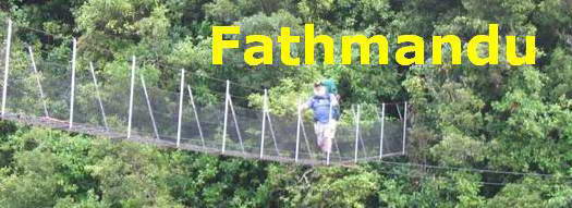
Out come the bright red Katmandhu pack covers and the bright yellow raincoats which have mostly been passengers on the Heaphy and St James. The cameras are located in snaplock plastic bags inside the carry bags.
Alice is in the van before us, and off we go to Lake Wainamu.
Not today, sorry. This is a STRICTLY NO DOGS track. Rethink, and we decide to head back down the Bethells Rd and complete that section of the Long Rd Track that we haven't done yet.
It's warm and dry inside the van. What are we, stupid?
Maybe.

Whose idea was this anyway?
At the moment you can still see the hills ahead of us. By the time we come back, the mist will have moved in over most of the track. I thought this was steep last time, but now we're carying 18kg or perhaps a little less. The rain is penetrating and the cameras stay packed.
One foot in front of the other, frequent stops to catch our breath. About 300 m in, my knee starts protesting.
"Darling, could you get the knee support out of my pack?"
Miranda is silent while she climbs a bank behind me, undoes the pack cover and delves right though my pack for the support. This is not always a good sign, and when she eventually discovers it in my top flap pocket, the silence deepens. I say nothing, and gratefully lock the support in place.
Uphill a little there is a loud yipping. Alice has discovered the same electric fence she discovered last time we were up here. She returns in a hurry to us.

As we waded through the long grass just past Sylvia's seat, our socks functioned as wicks, and without hitting even a small puddle, our boots were sodden in no time.
Inside the bush it is still wet, so I leave the camera in its bag until we hit the Lower Kauri Track Junction, where I got to last time. Fatman time today, 50 minutes.
The rain is easing a little, but there is plenty of water stored in the canopy above us, waiting for a sudden gust to deliver it.

The track is by and large firm clay, though on any kind of slope it needs care. Muddy puddles are scattered all the way along the track.
(It's a good indication of your physical state, incidentally, whether you clump straight through a puddle or negotiate a course around it. Clumping straight through is a pointer one is wise to attend to - a swig of water, a brief rest, an energy snack, maybe time to break out the polyprop vest if you're getting cold.) On the other hand you may be just a kid who likes splashing in puddles.)

We pass Wainamu Bush track heading off to the right


Ive always regarded time estimates with some caution, since the first day of the Heaphy Track, 17km gentle and inexorable uphill, some 700m total increase in altitude. At the bottom, it was signposted as a 5 hour walk, and the same time estimate was given at the top of the track for the downhill walk. Fatman time for the day was 8 hours.

With occasional dips the main trend of the Long Road Track is uphill as far as Simla, where it joins the Fenceline Track. Once the first, steep, gravel approach is past, it's a gentle climb, and for the most part accommodates walking side by side as does the Heaphy for much of its length.
Nevertheless it is surprising how distance apart on a track can vary. Sometimes a tight-knit small group, other times spread over half a kilometre or so. Miranda likes to strike a rhythm and keep it going. I like to potter and notice things along the way and take pictures.


We've arrived at Smythe Corner. As we get further along the track, rata becomes increasingly common at the edge of the track.

To the right, Smythe Ridge Rd heads off towards Anawhata and Bethells.
I decide to investigate this further. This road is unsignposted, while a bit further along the track, a brand new sign points to Smythe's Ridge Track, which is not marked on my topo sheet.

If we compare topo and ARC maps of the area, the section of ARC map below shows two entries to the Smyth Ridge Track, the northern one being from Smythe's Corner along Smythe's Ridge Road, with Sisam Track departing a little way down the track


section from ARC map
|